Bradford Parkinson: The father of GPS
by Ailsa Harvey · 26/11/2020
Meet the engineer behind the navigation system that we rely on daily
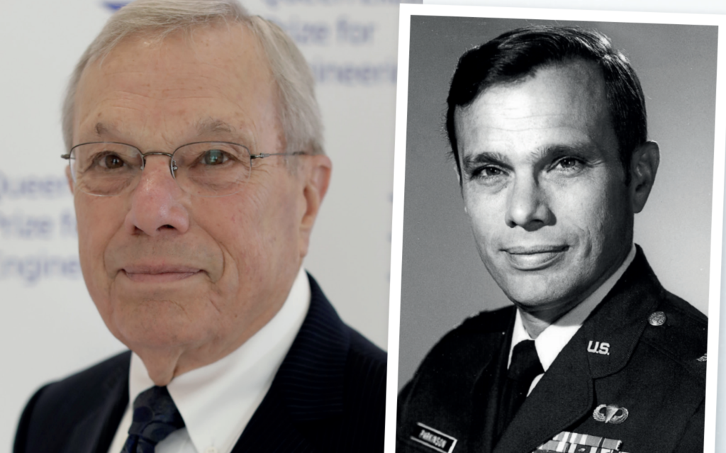
Image credit: Queen Elizabeth Prize for Engineering (left) and USAF (right)
Air Force Colonel Bradford Parkinson was lead architect for the Global Positioning System (GPS) program. In 1973 he convinced the US Air Force of the value of a new satellite-based navigation system. By building satellites and experimenting to improve them, Parkinson and his team provided the world with accurate positioning, navigation and timing services. The first GPS satellite was launched into space just 44 months after the team’s program was approved.
Parkinson went on to become a professor at Stanford University in 1984, the same university that he graduated from with a PhD in guidance control navigation. There he continued to explore the multitude of applications his team’s satellite service could achieve, including robotic tractors. From the maps on our phones to real time aircraft positioning for pilots, Parkinson’s lead role in this groundbreaking technology has resulted in some declaring him the ‘father of GPS’.
How did you get into engineering?
I don’t think I ever thought of myself as anything other than an engineer. It was not a serious question to me. When I was young, I made electronic amplifiers from scratch. This was back in the era of vacuum tubes, and they were all discrete components. I went to the US Naval Academy in Annapolis and education there was principally engineering, so I felt right at home. I graduated and went out in the Air Force as an engineering officer, and there I was trained in aircraft avionics.
Whose idea was it to create GPS?
There had been a previous satellite navigation system called Transit. It was, by our standards, quite crude, but it was worldwide. GPS can provide 24/7, 365 days a year coverage to the whole Earth, and Transit couldn’t do that. It would give you a relatively crude fix once every two or three hours. It was good enough for some Navy ships, but it wasn’t good enough to land aeroplanes. A study was done, and 12 techniques were highlighted as ways to navigate using space satellites. We selected the hardest, which provided four dimensions: latitude, longitude, altitude and very precise time. Two important breakthroughs had to occur. First we had to come up with a signal that was very unique. Back then we were experimenting with a new signal that was so quiet that if you looked at the radio spectrum you wouldn’t see it at all. Now everyone accepts it as a GPS signal, but there was great scepticism that it could be good enough to navigate. Today we navigate to a millimetre with it. Secondly, we wanted the satellites to go around the Earth, be autonomous and have clocks with stability better than one second in 300,000 years. We were trying to measure time to a fraction of a billionth of a second.
How did the Air Force respond?
The Air Force did not want this system; they fought it tooth and nail. I got in a lot of trouble in the Pentagon. I remember the two-star general taking his finger and sticking it in my chest and saying: “Parkinson, if you keep advocating this your career is going to go down in flames.”
Want to design the next QEPrize trophy?
The Queen Elizabeth Prize for Engineering is a global prize that celebrates the successes of modern engineering. If you are aged 14 to 24 with a talent for 3D design, the next trophy could be designed by you. Click here for details on how to enter the ‘Create the Trophy’ competition. The closing date for entries is 21 December 2020.
For more science and technology articles, pick up the latest copy of How It Works from all good retailers or from our website now. If you have a tablet or smartphone, you can also download the digital version onto your iOS or Android device. To make sure you never miss an issue of How It Works magazine, subscribe today!