
Nasa is launching a satellite to watch the world’s ice and forests
Credit:NASA’s Goddard Space Flight Center
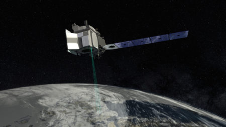
NASA is launching the newest version of a global monitoring satellite, which sends thousands of lasers done to the surface.
On Saturday, September 15th at 8:46 am EDT, NASA will launch the Ice, cloud and land Elevation Satellite-2 (ICESat-2) satellite into orbit.
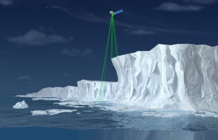
The primary objective of ICESat-2 is to record information about the Earth’s icy regions known as cryosphere and largest forest. The satellite will measure the height of ice sheets, glaciers, along with sea ice thickness and vegetation height to determine is quantity.
Aboard the ICESat-2 will be a single instrument called the Advanced Topographic Laser System (ATLAS) to measure the height of ice sheets, glaciers, sea ice and vegetation. ATLAS will send 10,00 laser pulses a second to the Earth’s surface each containing 300 trillion photons. Of that 300 trillion only a dozen or so will return directly to ATLAS to be recorded. Once received ATLAS can calculate the time taken to return and therefore the distance travelled.
The coverage ICESat-2 will allow researchers to track changes for both land and sea ice to better understand how they come about. ICESat-2 has been designed to provide information about our plant during a three-year lifespan.
Credit: NASA
Where to watch?
ICESat-2 will launch from Vandenberg Air Force Base in California, and both coverages of the prelaunch and launch are available to watch from the NASA’s website www.nasa.gov.
For more science and technology articles, pick up the latest copy of How It Works from all good retailers or from our website now. If you have a tablet or smartphone, you can also download the digital version onto your iOS or Android device. To make sure you never miss an issue of How It Works magazine, subscribe today!